Syren Nagakyrie worked in partnership with Visit Idaho to create this Travel Tip.
These three outings provide options for accessible wildlife viewing and birding opportunities within an hour of Boise. They are beautiful locations at any time of day, but the best time to visit is morning and evening when wildlife tends to be more active, which will also help you avoid the summer heat. Spring and fall are also great times of year, as wildlife becomes more active and birds migrate.
Eagle Island State Park
Eagle Island State Park is a 545-acre site bordered by the Boise River on the north and south, with a lake in the center of the park. The park’s semirural location surrounded by farmland makes it a perfect spot for wildlife appreciation less than 30 minutes from Boise. I heard and spotted numerous birds during my visit, including a great blue heron at the lake!
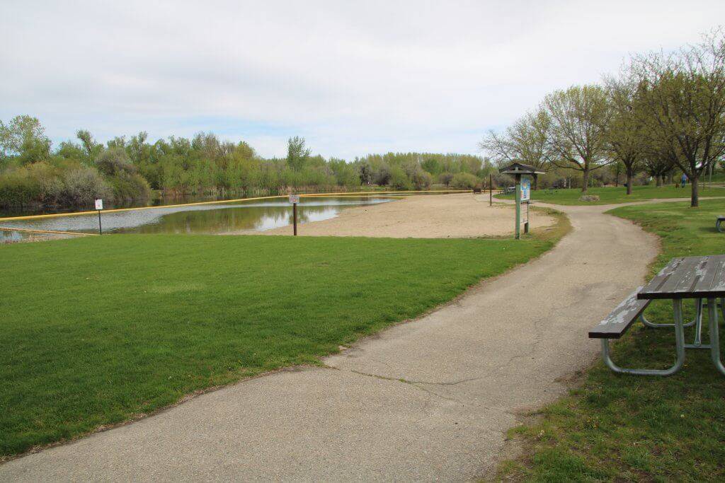
Eagle Island State Park Paved Trails
A one-mile paved loop leads from the parking area to the restrooms and visitor center, then to the lake. The path is about five feet wide and continues along the swimming beach with great views of the lake. The paved loop continues beyond the developed area for approximately 0.1 mile with a couple of spots to appreciate the lake through the trees before returning to the parking lot.
The beach is flat, but it is not accessible, and the sand is too soft for most wheelchairs and walkers.
There are lots of picnic tables along the way, but they are all in the grass with no accessible route of travel. Three reservable picnic shelters offer paved access routes with accessible tables, so you may want to call and confirm their availability if you want to have a picnic during your visit.
Hiking Trail for All-Terrain Wheelchairs
A 2.5-mile loop trail through the park is partially accessible for anyone with an all-terrain wheelchair or adaptive equipment and generally accessible for people who do not use a wheelchair.
This trail is an old farm road; it is used by hikers, bikers and equestrians, but there are places to move aside on the trail to allow people to pass. It is typically a divided doubletrack surfaced in compact gravel with areas of compacted sand and embedded rocks. It is generally flat and varies in width between three to six feet. Parts of the trail can be flooded due to irrigation.
To access the most accessible portion of the trail, turn left on the gravel road by a sign that says trailhead parking before you reach the main parking lot, and park in the gravel parking area on the right.
There are no designated parking spots here. You can travel along the wide, flat, hardpacked gravel road as it passes through the fields and past historic buildings.
There are wonderful views here, and I heard lots of birds. After you pass the horse parking lot on the right, the trail takes an 8% incline for about 20 feet, then veers left and follows the river. Pass through a gate, and then the trail becomes a divided doubletrack with a variety of surfaces and widths.
There is a nice, shaded bench on the river 0.4 miles past the gate; this may be a good place to turn around, as the trail becomes narrower and grassier up ahead. The trail crosses the road and continues along the river before veering left at a disc golf course station and returning to the lake.
Eagle Island State Park Accessible Wildlife Tips
- Park Fee: $7 per vehicle per day or an Idaho State Parks Passport ($10 for Idaho residents, $80 for out-of-state residents).
- Pets Allowed: Yes. There are on-leash and off-leash areas in the park.
- Getting There: 165 S. Eagle Island Pkwy., three miles west of Eagle. From Boise, take West State Street/State Highway 44 West for approximately 11 miles. Turn left onto Eagle Island Parkway. Follow this paved two-lane road for a half-mile into the park.
- Parking: Large paved parking lot. Turn right at a sign for the visitor center. There are at least eight designated accessible parking spots with curb cuts to the sidewalk, but most of the access aisles are only four feet wide. There are two van-accessible spots with an eight-foot-wide aisle at the west end of the parking lot.
- Accessible Features and Amenities: Gendered restrooms with an accessible stall and push-button metering faucets, picnic tables at pavilions (by reservation), open outdoor changing area shielded by an angled wall with long benches and no handrails or places to safely transfer.
Deer Flat National Wildlife Refuge
Deer Flat is a beautiful national wildlife refuge along the Snake River that includes the 9,000-acre Lake Lowell and more than 10 miles of trails. There are incredible views of the Owyhee and Boise Mountains, a number of recreation opportunities and a historic dam.
The area is primarily sagebrush uplands with forested areas along the lake, and it is an active spot for migrating songbirds, nesting osprey and other wildlife. The trails are generally exposed, so bring sun protection and extra water—there is none available on the trails.
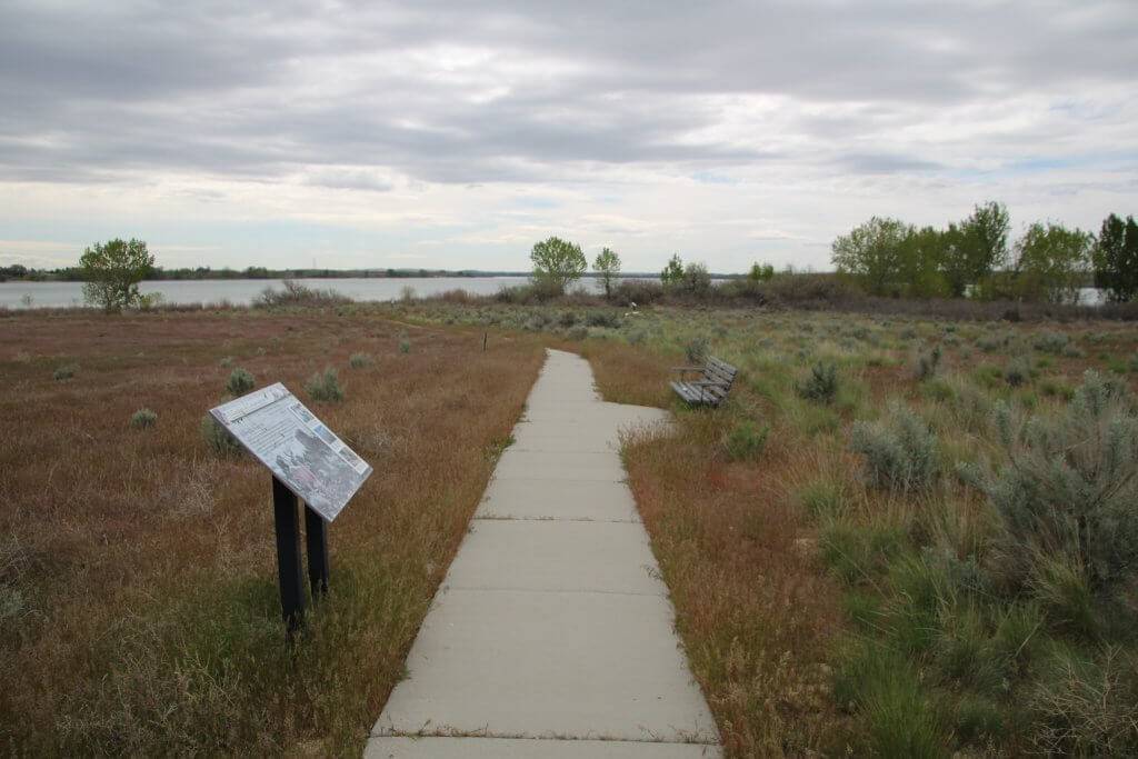
Deer Flat National Wildlife Refuge Paved Trail
The Centennial Trail is a 2.4-mile round-trip trail with interpretive signs about the history of the refuge, an accessible wildlife viewing blind and an observation platform.
The west end of the trail, starting at the visitor center, is the most accessible. It is surfaced with concrete and starts with a 5% decline for approximately 30 feet before leveling out and winding through the sagebrush with interpretive signs and benches along the way.
The concrete is occasionally imprinted with animal tracks, which can be a fun way to test your identification skills. I would have loved to see interpretive signs with this element to allow for a multisensory experience!
A ramp made of composite boards leads to an enclosed wildlife viewing blind. The door is a bit difficult to open—I had to put some weight behind it—and there is a one-inch lip at the threshold. The blind windows are covered by hinged doors and placed at sitting and standing heights, and there are a couple of chairs available. There is very low light inside the building, especially with all of the blind windows closed.
The Centennial Trail continues past the viewing blind. There are a couple of places where the outer edge of the concrete is eroded with a drop-off that could catch wheels, then the trail takes a 5% incline for 30 feet and crosses the road. The observation platform is ahead. There are sections of broken and raised concrete between one and three inches at the platform, but they are passable with caution.
A ramp leads up to the observation deck, which also has a section of collapsed boards, but they can be avoided with care. The platform provides open views of the surrounding sagebrush uplands, the lake, wetlands and the mountains.
The trail then meets the boat ramp parking area on the west side of the dam. A concrete path leads to a fishing pier that is signed as accessible, but the route is very steep, and there is a high lip onto the dock.
The trail continues over the historic dam. The surface changes to very rough asphalt embedded with river rocks and loose gravel, so it could be a very uncomfortable ride. The dam wall provides places to sit, and there are more interpretive signs.
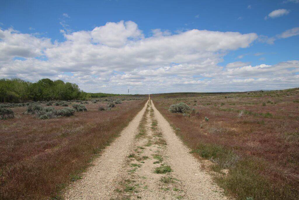
Hiking Trail for All-Terrain Wheelchairs
The Observation Hill Trail starts across from the visitor center at the east side of the parking area. It is a 3.25-mile lollipop loop and is primarily a doubletrack road with large and loose gravel. The trail begins on a slight grade, then forks for the loop.
The most level section is to the left—this section of the loop travels for approximately a mile along the tree-lined shore of Lake Lowell. The other half of the loop ascends and descends a couple of hills with grades up to 10%. An observation deck at the top of the hill provides incredible views.
Deer Flat Accessible Wildlife Tips
- Pets Allowed: Yes, on leash.
- Park Fee: None.
- Getting There: 13751 Upper Embankment Rd., Nampa. From Boise, take Interstate 84 west to exit 33, and turn right (west) onto State Highway 55/Karcher Road. Continue 3.5 miles and turn left onto Lake Avenue. In 2.5 miles, turn right onto Roosevelt Avenue. Turn left at Indiana Avenue into the refuge, descending the hill and continuing to the visitor center.
- Parking: Paved lot with two accessible parking spots with a four-foot-wide access aisle near the visitor center.
- Accessible Features and Amenities: Restrooms in the visitor center (may be closed depending on season), vault toilets at the boat launch.
Morley Nelson Snake River Birds of Prey National Conservation Area
The Morley Nelson Snake River Birds of Prey National Conservation Area (NCA) is truly a place not to miss. It is home to the highest concentration of nesting birds of prey in all of North America. Towering cliffs rise 700 feet above the winding Snake River, where countless raptors nest and hunt, soaring high above the canyon. The NCA spans 484,000 acres with multiple recreation opportunities.
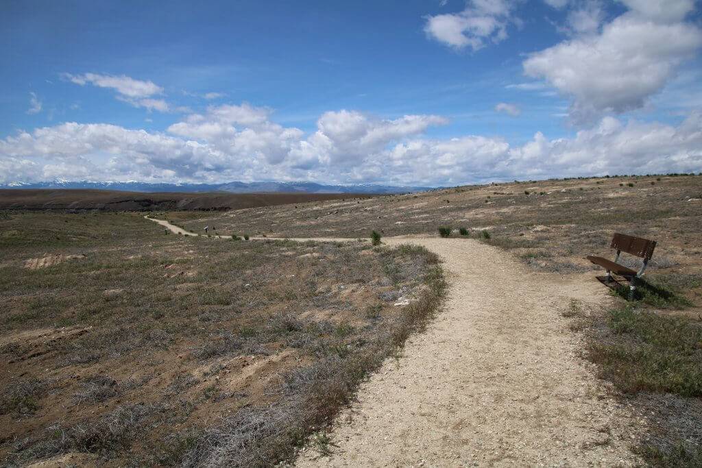
Snake River Birds of Prey NCA Scenic Drive
A 60-mile scenic loop begins at the Kuna Visitor Center (you can download a guide from the BLM website or pick one up at the visitor center). The drive takes you through part of the NCA and offers many opportunities for wildlife appreciation along the way, as well as scenic vistas and cultural sites. From Kuna, take Swan Falls Road south.
At mile eight, you pass Initial Point on the left, but the access road is severely eroded and the point is not accessible.
At mile 12, you pass the intersection with Victory Lane, which heads west to Celebration Park. The park is not particularly accessible—there is no van-accessible parking, and access to the trails is blocked by boulders or gates with less than three feet of clearance. However, if those issues are not barriers for you, then it is a beautiful place to visit.
The trail along the river is generally level, but the petroglyphs trail is rocky and steep in places. A historic bridge spans the Snake for an incredible experience of soaring above the canyon (a grated barrier guards the edge of the bridge).
Dedication Point
Continuing south on Swan Falls Road, you reach Dedication Point at mile 15.5. A gravel parking area is on the right with accessible vault toilets.
This all-terrain trail leads to a truly stunning overlook of the Snake River Canyon. It starts with some deep, loose gravel for the first 20 feet from the trailhead, but then becomes compact sand with some loose gravel.
It is a lollipop loop, but only the right side of the loop is accessible—there is an accessibility sign at the end of the loop, but not at the beginning—and the left side has prolonged 8% grades. There are benches and interpretive signs along the way. There is a rock wall barrier at the overlook with sections that are lower to allow a person to see from sitting height, but to reach it, you have to take a short 8% to 10% decline.
Swan Falls Dam and Park
Continue on Swan Falls Road to the gravel pullout on the left at mile 18, just before you descend into the canyon. This is a great place for birding above the Snake River Canyon. Then continue another two miles to the Swan Falls picnic area.
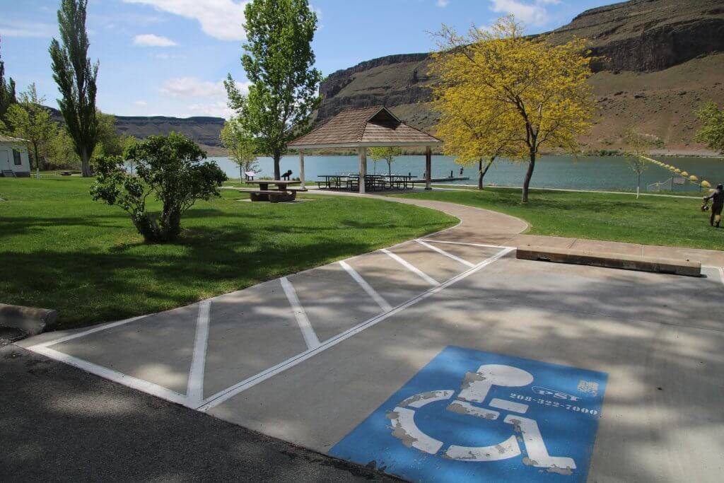
The Swan Falls Dam and picnic area is the only paved accessible location along this route. A concrete path winds through a lovely grassy picnic area with accessible tables along the river. An accessible fishing dock is available, but the sidewalk to it is raised about two inches.
There are flush restrooms with an accessible stall (bring your own soap or hand sanitizer). A metal grated deck travels along the edge of the historic building and across the dam, with access to rugged trails on the opposite side of the river.
Snake River NCA Accessible Wildlife Tips
- Pets Allowed: Yes, on leash.
- Park Fee: Day use fee at Celebration Park. Otherwise, no fee required.
- Getting There: Begin at the Kuna Visitor Center/Chamber of Commerce at the intersection of Avalon Street and Swan Falls Road. From Boise, take I-84 west toward Nampa. Take exit 44 for State Highway 69/South Meridian Road. Continue 13 miles to the intersection with Swan Falls Road.
- Parking: Gravel undesignated parking at Dedication Point, paved van-accessible parking at Swan Falls picnic area.
- Accessible Features and Amenities: Restrooms, picnic tables.
Feature image credited to Syren Nagakyrie.
Syren Nagakyrie is the founder of Disabled Hikers, an organization building disability community and justice in the outdoors. They are the author of The Disabled Hiker’s Guide to Western Washington and Oregon: Outdoor Adventures Accessible by Car, Wheelchair and on Foot and the forthcoming The Disabled Hiker’s Guide to Northern California. Learn more at disabledhikers.com.
Updated on January 20, 2023
Published on June 14, 2022
